
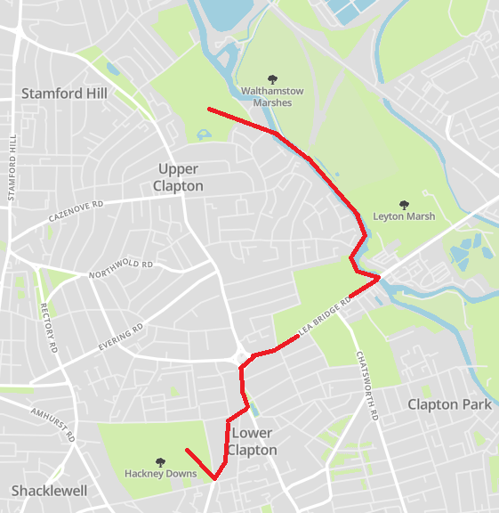
Thanks for joining me as I discover another part of the great city of London! Today’s walk explores the East side of the capital, uncovering some of the lovely parks that it has to offer as well as a beautiful walk along a stretch of the River Lea. My walk begins at Hackney Downs, takes me via Clapton and Millfields Park, before a riverside stroll, and ending at Springfield Park.
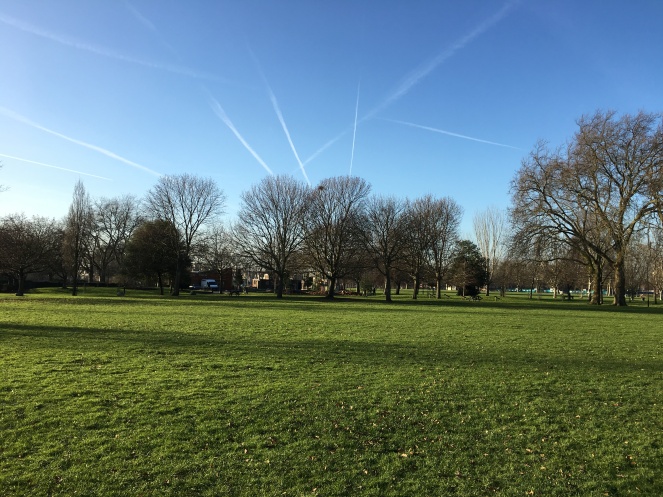
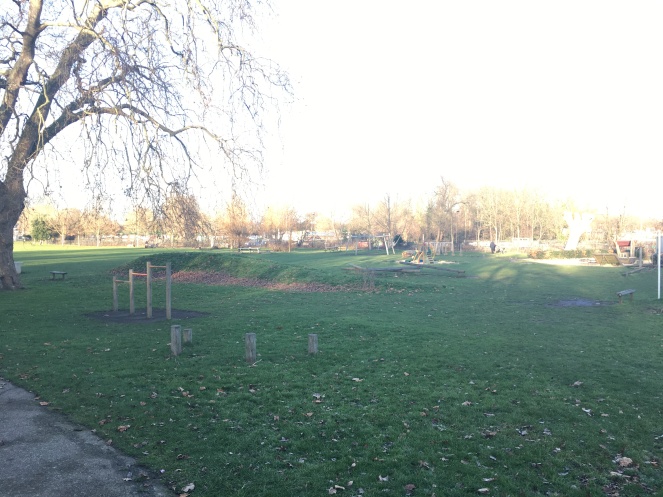
My journey starts at Hackney Downs which is a former Lammas land dating back to the 1860s. Before then in the 18th century horse racing took place there, with cricket, football and rugby clubs also using the land.
In 1872 The Metropolitan Board of Works acquired the Downs from the Lord of the Manor, Mr Tyssen Amherst, and through an Act of Parliament, it became a public open space. This was prompted due to local residents in the 1860s trying to enclose and conserve all of the 180 acres of land.

It wasn’t until 1884 that the Downs were opened as a public park with paths laid out in it and trees planted within it. In 1965 it became the responsibility of Hackney Council, who took over the helm of managing it from the London County Council.
Throughout the years the area has seen various facilities added including women’s toilets in 1908 (hard to believe there were only men’s there…), the Hackney Downs Lodge in 1959, an extension to the bowling green in 1960, as well as a playground and sports courts. The park had major works undertaken on it in 2010 with new tennis courts, a multi-use games area, a play area and various sports pitches added to it.
It does have that real park feel about it which makes it very different to other parks such as Hyde Park and Green Park with the sporting element within it. A perfect place to enjoy a peaceful lunch, or a run, or to walk your dog!
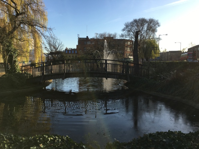
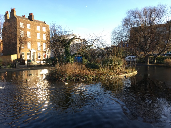
A walk past Hackney Downs Overground Station takes me to this cute little pond. Clapton Pond has existed since the 1600s, and re-landscaped in the late 1800s for public use. The Pond has been awarded the Green Flag Award which is given to the best green spaces in the country.
It’s quite a distinct feature of the town of Clapton and the surrounding area as amongst the shops, roads and houses, you find this picturesque pond placed in the middle of them. The pretty bridge going over the water reminds me of Claude Monet’s painting, ‘The Water Lily Pond’. Quite a contrast in scenery, but you get where I’m coming from with its shape…!


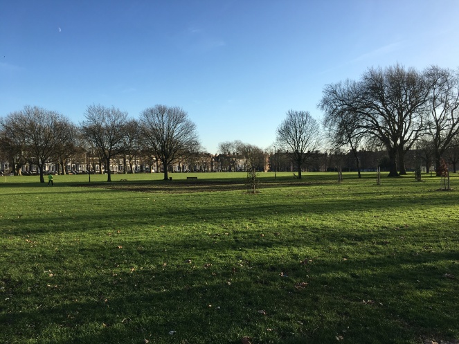
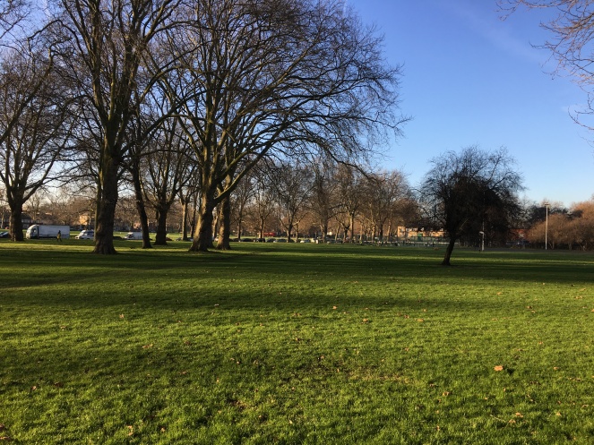
Through the houses of Clapton I come across another one of East London’s green areas, Millfields Park.
At the end of the park I join the River Lea! The Lea Valley Walk is 50 miles (80km) long between Leagrave, the source of the river near Luton, to the Limehouse Basin near Canary Wharf.


The walk which was opened in 1993 can be split into four stages: Leagrave to Hatfield; Hatfield to Broxbourne; Broxbourne to Lea Bridge Road (Walthamstow Marshes) and Lea Bridge Road (Walthamstow Marshes) to the Limehouse Basin. Within the 50 mile stretch, 18 of these are within London’s boundaries, and pass through areas including Walthamstow, Tottenham Hale and Bow. I joined it at stages 3/4, however, one day I’d love to do the entire stretch!
The Lea (or Lee) marked the boundary between pre-Roman tribal territories, and later formed the frontier between Alfred The Great’s land, and the Danelaw. Recently it has become the transition between Middlesex and Essex, and still forms the boundary between Essex and Hertfordshire to the north.
I must say walking along this stretch of river is up there with my favourite walk on the Regent’s Canal, as it has the same beautiful features. Crisp, blue water as far as the eye can see. Pretty houses on the route. Wonderful reflections in the water. Plenty of canal boats. And an abundance of greenery, with the marshes in between the river and the towpath. It’s so peaceful walking through it, and I’m very jealous of the people who have the river as their window views!


I’ll now leave the Lea Valley Walk to visit my final destination today, Springfield Park! Occupying 14.73 hectares (36.4 acres) of green land, the park is located in Upper Clapton in the Borough of Hackney. In Georgian era Springfield House stood on the main entrance to the park and by the mid-Victorian period housing estates in the area were developed.
However, in 1902 the private estates and land in the area were sold off, with the park put up for auction. A group of local businessmen saved the park and eventually the London County Council took over the responsibility of it. In 1905 the park was opened to the public!
I’ve discovered many parks on my walks, and they all seem to have their own unique features and are all different in some way. Springfield Park has a really steep hill and incline, something not seen in many other areas in London, and with the backdrop of the River Lea behind it, it certainly is a perfect way to end a walk!


It has been a wonderful walk exploring more of East London’s natural wonders and discovering the gems along the Lea Valley Walk! Hope you’ve enjoyed my walk, and please share your thoughts in the comments section below! You can catch me on Twitter, Instagram and Facebook, and don’t forget to sign up to my blog too!
Until next time, have fun walking, and see you soon!
Sources: (not the food sauces)
All photos taken by London Wlogger. © Copyright 2017
History of the Hackney Downs – London Gardens
History of Clapton Pond – Hackney
Map of the Lea Valley Walk – Cicerone

Lovely walk and looks like you had great weather!
LikeLiked by 1 person
It’s such a nice stretch of water, and quite hidden away in North-East London!
LikeLike
We love that sideof London, we like cycling that way. Great photos, shame it’s not always this sunny but then the grey weather has its charm too.
LikeLiked by 1 person
It’s a perfect cycling route with the long stretches of pathway and waters, must be amazing flying through it on a bike!
LikeLiked by 1 person
It truly is, especially if you’re able to cycle during the week when it’s less busy than on weekends. You should try it 😉
LikeLiked by 1 person
Haha I’d have to rename the blog London Clogger – (Cycling Blogger)! 😉
LikeLiked by 1 person
Terrific post. Thank you. I hope to walk some of it someday.
LikeLiked by 1 person
Aww thanks, Sherry! Glad you enjoyed it 😊
LikeLike
Another new area for me.
“Throughout the years the area has seen various facilities added including women’s toilets in 1908 (hard to believe there were only men’s there…)”
That’s because Victorian-era women never needed the loo: It’s just not done, you know. We have no bodily functions.
LikeLiked by 1 person
Thanks for the enlightening fact!
LikeLike
When I lived in Highbury, London, I used to walk in Lea Park which was not as nice then as it is today (after its Olympics makeover) but it was still a lovely quiet spot. Your images are really good, too.
LikeLiked by 1 person
Thank you for sharing your lovely memories, it’s certainly one of the most picturesque places I’ve visited!
LikeLike
I could clap for Clapton Park. Your water views are beautiful.
LikeLiked by 1 person
Nothing better than a watery wonder!
LikeLike
Love that — watery wonder.
LikeLiked by 1 person
My grandfather was born in Hackney and on my April visit to London I plan to find the house. To round out that day, how long is this walk you describe (in time or miles)?
LikeLiked by 1 person
Sounds like a good plan! This walk took about 45 minutes 😊 Hope you enjoy doing it and you find your grandfathers house!
LikeLike
Love taking these strolls with you! London’s my favorite city and while I’m not able to return just now, it’s lovely to get there this way – thanks!
LikeLiked by 1 person
That’s awesome to hear, Amy! Glad I’m bringing you closer to the city and showcasing all of London’s beauty 😊
LikeLiked by 1 person
Another lovely walk with fab pictures. Thank you for sharing!
LikeLiked by 1 person
Thank you for your lovely comments!
LikeLiked by 1 person
Another great entry. Its wonderful how much nature remains in London for those who seek it out.
LikeLiked by 1 person
Thank you 😊 It’s one of the many reasons I love London with all the green areas and watery wonders!
LikeLiked by 1 person
Wouldn’t it be a treat to live along the water and have those beautiful views. Funny you should mention the men’s only toilets. There is a toilet block here, on one of our main streets, that is heritage listed but no longer in use. It was for men only and dates from the 19th century. The women had to go to the CWA facilities in another part of town. Anyway, last year the area where the toilet block is located underwent massive redevelopment and because the building is listed, it had to be removed brick by brick and then reassembled in the same location. Of course, that was at ratepayers’ expense! It’s not even attractive.
LikeLiked by 1 person
Oh gosh that’s pretty absurd! Glad you enjoyed the walk 😊
LikeLiked by 1 person
My sister did one of your walks yesterday and found herself in the middle of a Where’s Wally fun run on Clapham Common! She loved it.
LikeLiked by 1 person
Haha, oh awesome, that’s so great to hear! 😊 It wasn’t too hard to find Wally then?!
LikeLiked by 1 person
She sent me a photo – there were dozens of them!
LikeLiked by 1 person
Amazing, it’s the perfect place for photos!
LikeLiked by 1 person
another great walk!
LikeLiked by 1 person
Glad to hear it, Tanja! 😊
LikeLiked by 1 person
What a beautiful walk. Lot’s of waterways and ponds to enjoy.
LikeLiked by 1 person
The best kind of walks!
LikeLike
Oh wow, awesome pictures (that bridge!) ❤
LikeLiked by 1 person
Thanks Samantha! London’s beauty takes all the credit!
LikeLiked by 1 person
Maybe, but you have a gift for capturing that beauty
LikeLiked by 1 person
Perhaps 😉
LikeLiked by 1 person
Spring is such a beautiful time to explore London. Enjoy!!
LikeLiked by 1 person
It’s always more of a pleasure walking around in the warmer sun!
LikeLiked by 1 person
Wonderful photos and what a great walk. I love the Lea Valley Walk but need to go back and do more of it. Looked fabulous.
LikeLiked by 1 person
Glad to hear you enjoyed it 😊 It’s definitely one to do, very picturesque and adventurous!
LikeLiked by 1 person
It’s always more of a pleasure walking around in the warmer sun!
http://www.nikitapoker.info/
LikeLike
Wouldn’t it be a treat to live along the water and have those beautiful views. Funny you should mention the men’s only toilets. There is a toilet block here, on one of our main streets, that is heritage listed but no longer in use. It was for men only and dates from the 19th century. The women had to go to the CWA facilities in another part of town.Agen Poker Online Terepercaya
http://vivapoker168.com/
LikeLike